
The National Hurricane Center reports that Matthew has evolved into a Category 3 hurricane with winds reaching 115 mph before 11 a.m., according to the Orlando Sentinel.
The Center calls any storm with winds above 110 mph a "major hurricane." As of now, Matthew is expected to turn northwest and reach Jamaica late Sunday.
Models still show the hurricane sparing the east coast of Florida, but like we've seen before, that depends on how quickly it moves. If it turns later than predicted, it could directly impact the state and even head for the Gulf of Mexico.
Haiti is also expected to be affected by the storm on Sunday night.
"Unfortunately, there is still some important forecast uncertainty regarding those important details, which is common for a tropical cyclone forecast several days out," writes The Weather Channel.
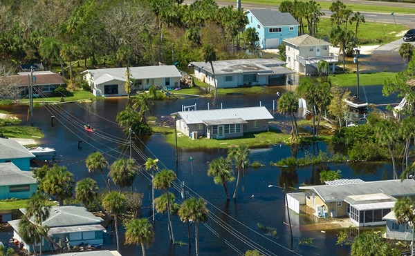
Though it's not expected to hit Florida until next week if at all, swells and coastal flooding are expected near the eastern seaboard as the storm gets closer.


WE LOVE OUR READERS!
Since 1990, Orlando Weekly has served as the free, independent voice of Orlando, and we want to keep it that way.
Becoming an Orlando Weekly Supporter for as little as $5 a month allows us to continue offering readers access to our coverage of local news, food, nightlife, events, and culture with no paywalls.
About The Author

Scroll to read more Orlando Area News articles


© 2024 Orlando Weekly
